
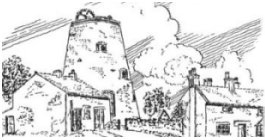
The Windmill - The windmill at the top of Werrington is believed to date from around 1730. It stands at the highest point of the road from Bucknall to Cellarhead (880ft). Towards the end of it's life, it was used for the grinding of coal to make 'Bricketts', and during the World War 2, it was the headquarters of the local Home Guard. Today, it houses communication equipment.
Dead Mans Grave - At the junction of Draw Well Lane and Armshead Road is the point known as Dead Mans Grave, so called because a man was 'waylaid, robbed and murdered' here (a long time ago it should be said !). In the dividing hedgerow of the corner bungalow is a stone which, according to legend, is the remains of the dead mans headstone. In actual fact, it's more likely the boundary marker stone mentioned in a citation of the boundary between the parishes of Stoke and Caverswall in 1689.
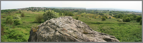
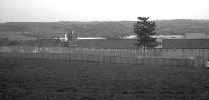
Wetley Moor - Now only around a quarter of it's original size, the Moor has been managed by a Joint Committee since 1928. At the highest point is a Triangular pillar used for Ordnance survey purposes as it is one of the highest points in Staffordshire (just over 900ft). Near to this is a large rock (top right in the picture above), and the last remains of Armshead Quarry, closed in the 1950's and now completely filled in. This was one of two quarries in Werrington, the other being situated in Washerwall, at the bottom of the Moor. One of Werrington's two churches, St. Philp's is built mostly out of local stone. If you stand at the top of the Moor, you can also still distinguish the route of the old main road which ran from Bucknall to Cellarhead, until Ash Bank Road was opened around 1777. The picture below shows the view of the moors from the top of the 'big rock'.
Young Offenders Institution - Opened in 1870 as an Industrial School, it used to consist of an old farmhouse, 2 adjacent cottages and a barn which had been a 'Chapel of Ease'. In 1933, it became an Approved School before changing to a Detention Centre in 1957, and then a Young Offenders Institute in 1983.
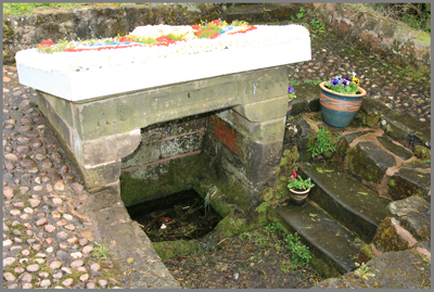
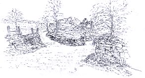
Washerwall Well - The only remaining well on Washerwall Lane, known as 'Spring Well'.
Further information may be found on the following link:
http://thepotteries.org/photo_wk/187.htm
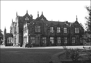
Ash Hall - The 'Manor' of Werrington. Built mostly from local stone, Ash Hall was originally constructed for the Meigh family. It is currently used as a retirement home. Further details and pictures of the Hall can be found on the link below:
http://www.thepotteries.org/walks/ash_hall/index.htm
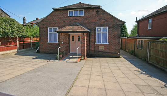
The Village Hall - Opened in 1938, the village hall has become the social centre of the district, even housing the Doctors Surgery for several years. Today, it is used for a whole range of activities including the children's Playgroup and meeting place for the local Parish Council.
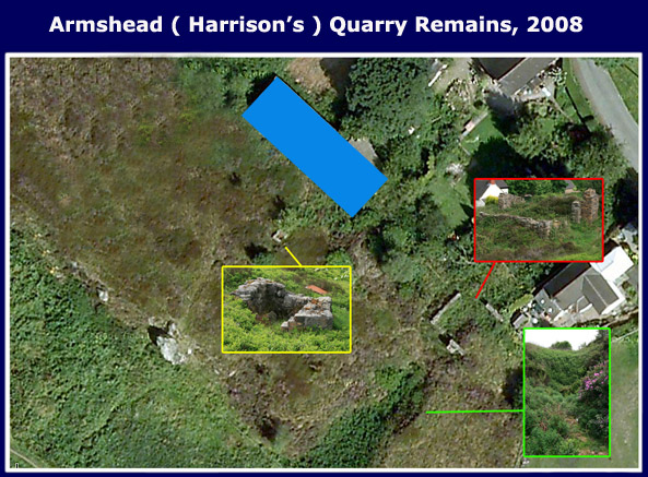
Blue Border - The Slabbing Shed - This is the remains of the 'Slabbing Shed' where the sandstone was compacted and laid out to dry in the slab moulds.
Yellow Border - The Powder Shed - The remains of the small hut where the sticks of dynamite used for blasting would have been kept.
Green Border - The Gully - Although mostly filled in now, you can still see the path of the gully that the trucks were pulled up from the quarry to the drying and grinding shed. (You can see pictures of the gully inoperation on the 'Picture Gallery' page.)
Red Border - The Drying Shed - This is where the sandstone from the quarry was dried out and ground into sand. At the rear of the shed was a loading bay, where the sand would be shovelled into the back of waiting delivery wagons.
Memories of the Quarry (Submitted by Mr. Tony McNicol)
My father used to be the Foreman at the quarry along Armshead, and when I was a lad I used to go along sometimes during the school holidays to help the men to quarry the stone.

(Pictured left to right are G.McNicol, K,Bowyer, A.Bloore, and W.Hawthorne)
It was ‘blasted’ out from the rock face, (whilst they were ‘blasting’ a man had to go onto Armshead Rd, & stop the traffic because small pieces of rock would sometimes land on the rd). After it had been blasted out the stone was loaded into small railway trucks, which were then hauled up a ‘gully’ from the quarry by a steel rope connected to a ‘winch engine’ into the ‘drying shed’ at the top of the slope.
The stone was then piled onto some very large - long metal plates, which had a fire underneath them & then left there until it was dry. It was then put into a machine with large metal rollers which crushed it into very small stones, then into another machine of the same kind which crushed it into sand.
The sand was then shovelled into a storage bay until a lorry came to collect it, the lorry reversed right up to the storage bay, then it was shovelled onto the back of the lorry (the storage bay was situated higher than the backs of the lorries, so the men had to shovel the sand ‘down’ onto the back of the lorry), then it was taken to Harrison’s in Lichfield St. Hanley for making pottery.
There was also another very long shed running east to west that was used for the making of flagstones & concrete ornaments, (a few of which I still have around the yard), & a very small ‘hut’ near to the big rock & away from any of the buildings that was used for the storing of the dynamite for blasting.
The quarry was closed down around 1955.
The quarry has been filled in with refuge, & then levelled out so that you cannot tell that there was ever a quarry there now. I estimate that the height from the top of the quarry to the bottom would be approximately 30 to 40ft.